Historic Northport Area Maps
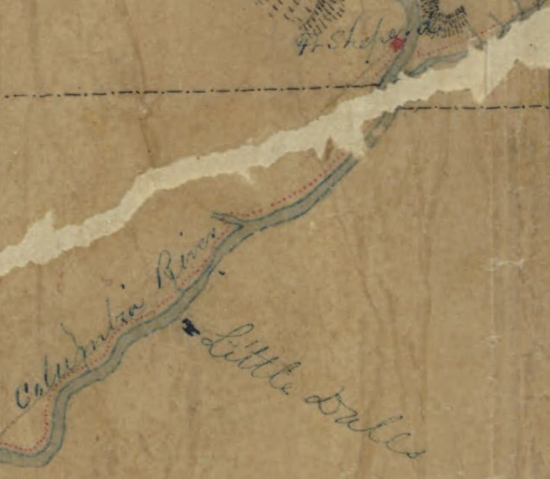
[1]
Fort Shepherd was established in 1856 at the mouth of the Clark's Fork or Pend D'Oreille River by the Hudson Bay Company to replace Fort Colvile which was in the newly established U S territory
Little Dalles was the jumping off point for travel up the Columbia River and was connected by road to the military Fort Colville and Pinkney City
Little Dalles was the jumping off point for travel up the Columbia River and was connected by road to the military Fort Colville and Pinkney City
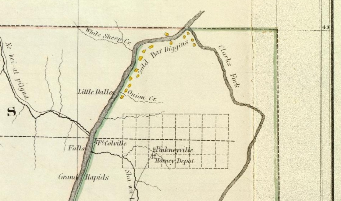
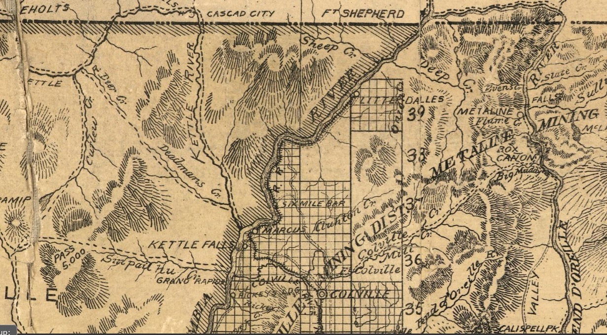
[2]
Detail of a U S General Land Office map of Washington Territory 1866
Beginning in the 1860's the rivers and creeks were placer mined for gold, shown here as
"Gold Bar Diggins"
Beginning in the 1860's the rivers and creeks were placer mined for gold, shown here as
"Gold Bar Diggins"
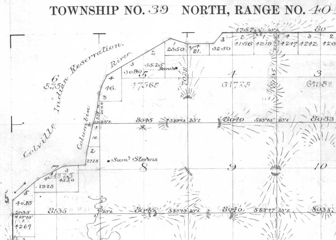
[3]
1885 Cadastral Survey Map
the location of the "Ranch" in section 5 is approximately at 4th street and Center ave.
the "Sam Stevens" homestead appears to be on the lower flat south of Northport
near Fivemile creek
the location of the "Ranch" in section 5 is approximately at 4th street and Center ave.
the "Sam Stevens" homestead appears to be on the lower flat south of Northport
near Fivemile creek
[4]
detail of 1891
Sectional map of Washington, Oregon, Idaho, and western Montana. Publisher: C.H.Amerine
Little Dalles is a small town at the terminus of the Spokane Falls and Northern railroad
Sectional map of Washington, Oregon, Idaho, and western Montana. Publisher: C.H.Amerine
Little Dalles is a small town at the terminus of the Spokane Falls and Northern railroad
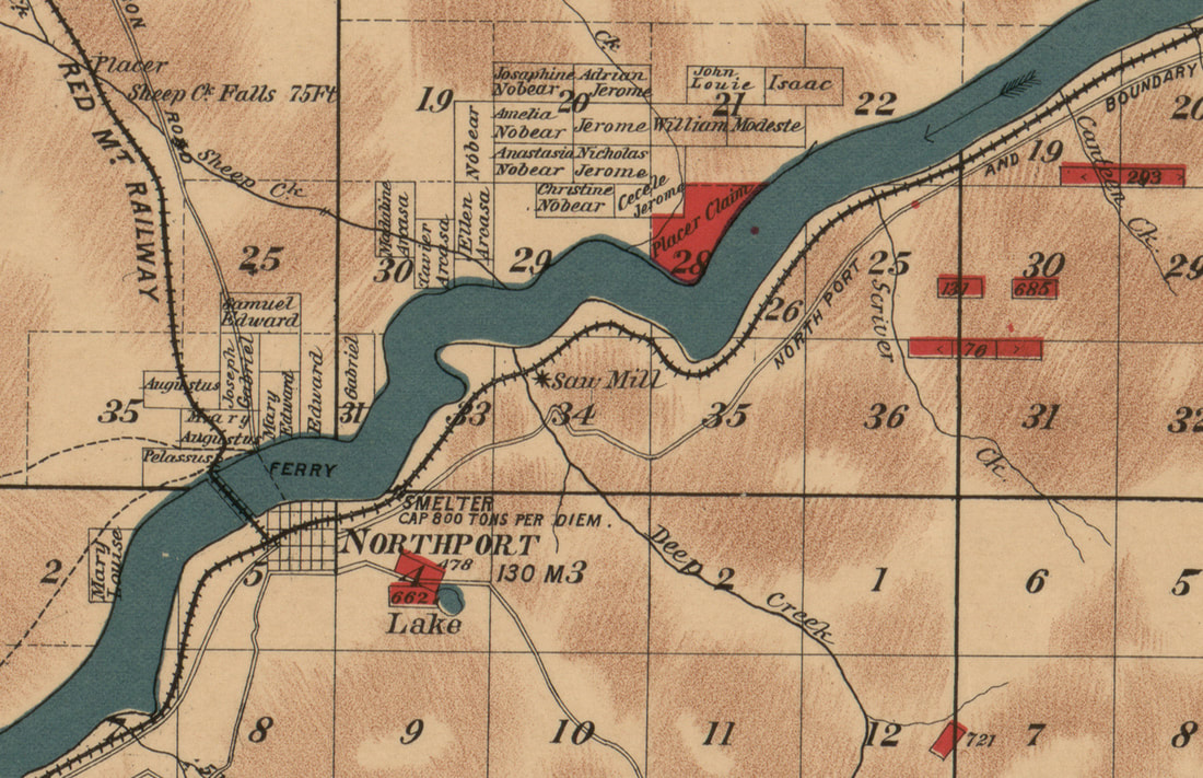
[5]
1900 Stevens County Mining Map
showing mining claims and Indian allotments
showing mining claims and Indian allotments
|
[6]
|
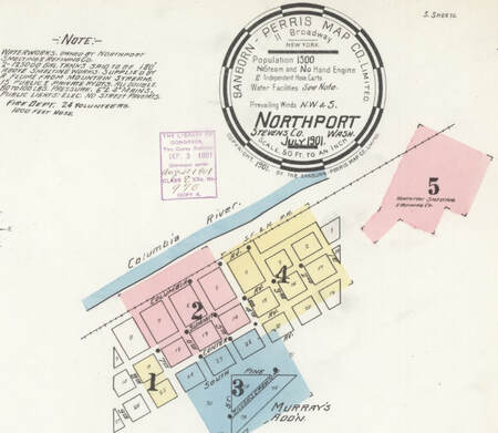
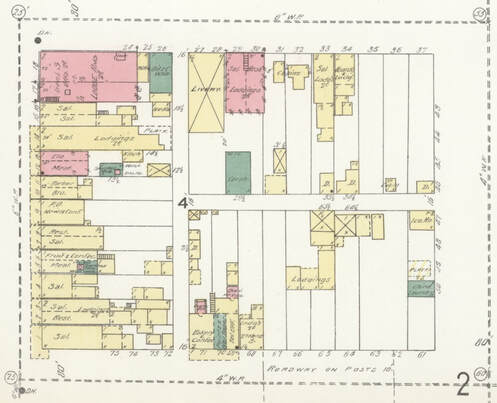
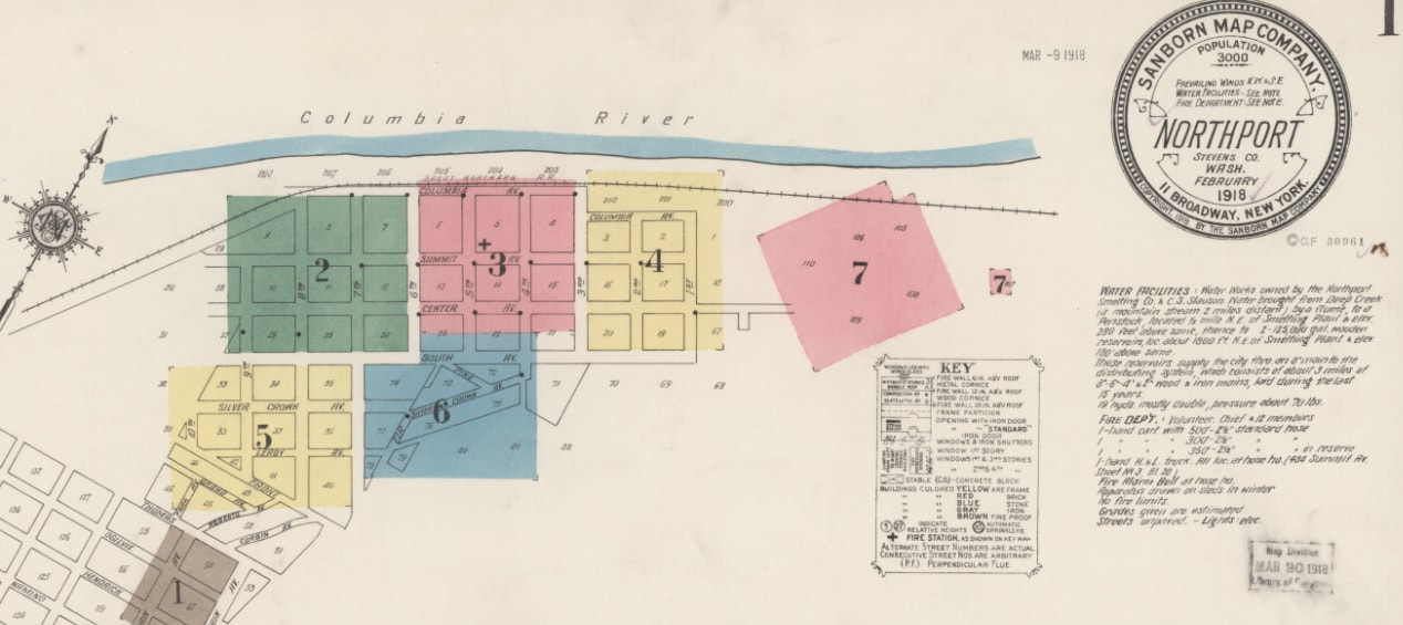
1901 Northport
Sanborn maps are detailed maps of U.S. cities and towns in the 19th and 20th centuries. Originally published by The Sanborn Map Company, the maps were created to allow fire insurance companies to assess their total liability in urbanized areas of the United States.
shown here are portions of page 1 and block 4 from page 4
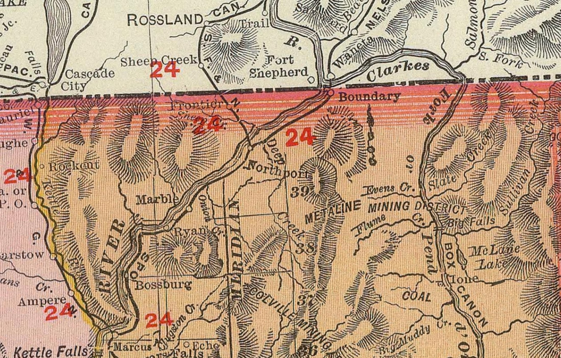
[7]
Atlas Map, 1903, Washington, Rand McNally and Company, Chicago
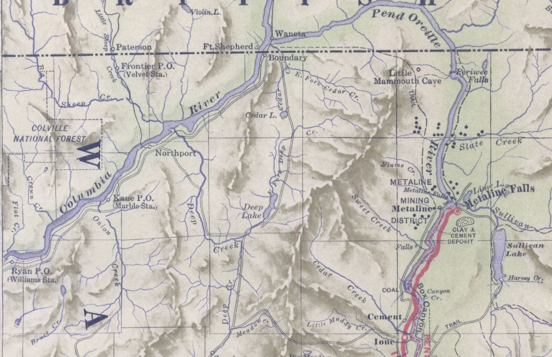
[8]
detail 1910 Railroad Map
[9]
1918 Northport Sanborn map
portion of page 1
access these maps at: www.loc.gov/collections/sanborn-maps/?q=northport,++washington
portion of page 1
access these maps at: www.loc.gov/collections/sanborn-maps/?q=northport,++washington
1926
when the road to Frontier (Velvet) was on the old Columbia and Red Mountain Railway line
when the road to Frontier (Velvet) was on the old Columbia and Red Mountain Railway line
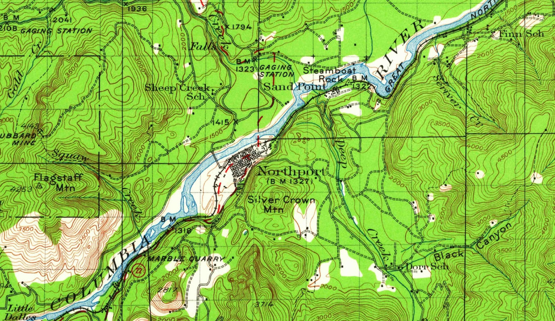
[10]
1929 USGS topographical map
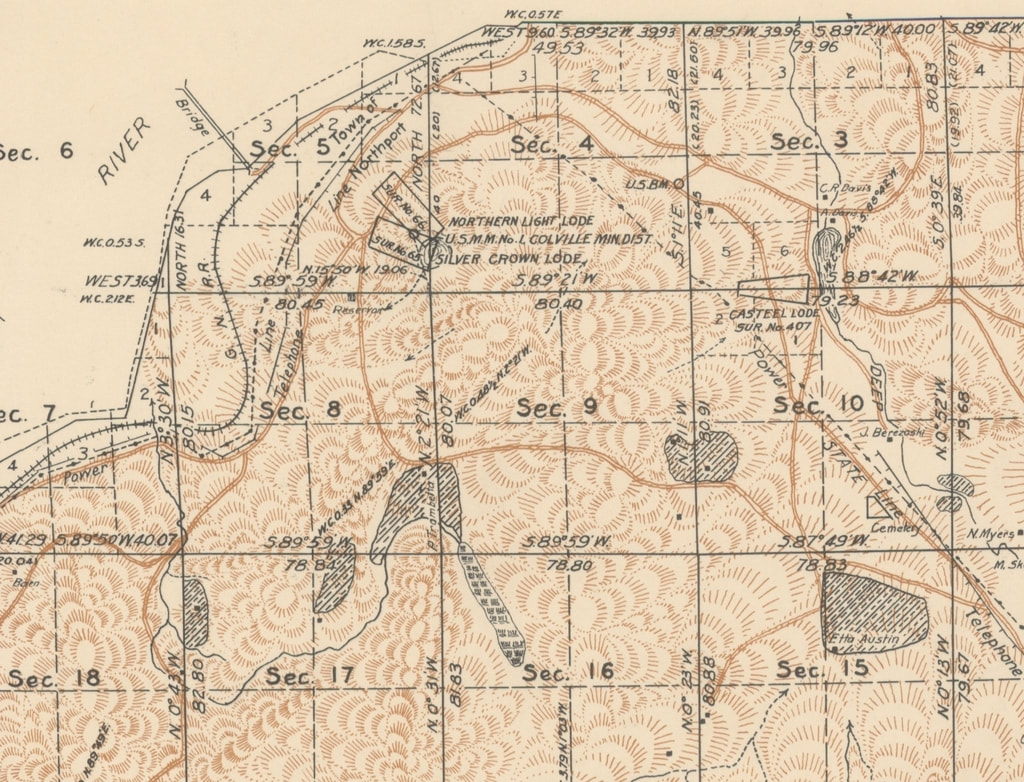
[11]
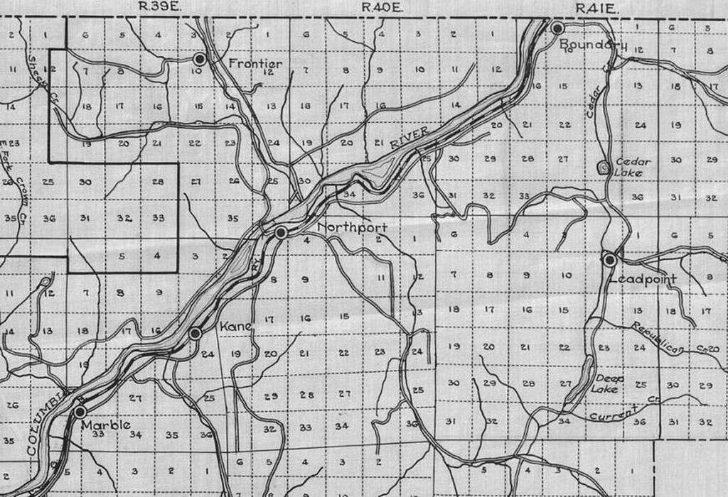
detail from 1935 survey map
showing mining claims, roads, power and telephone lines
showing mining claims, roads, power and telephone lines
[12]
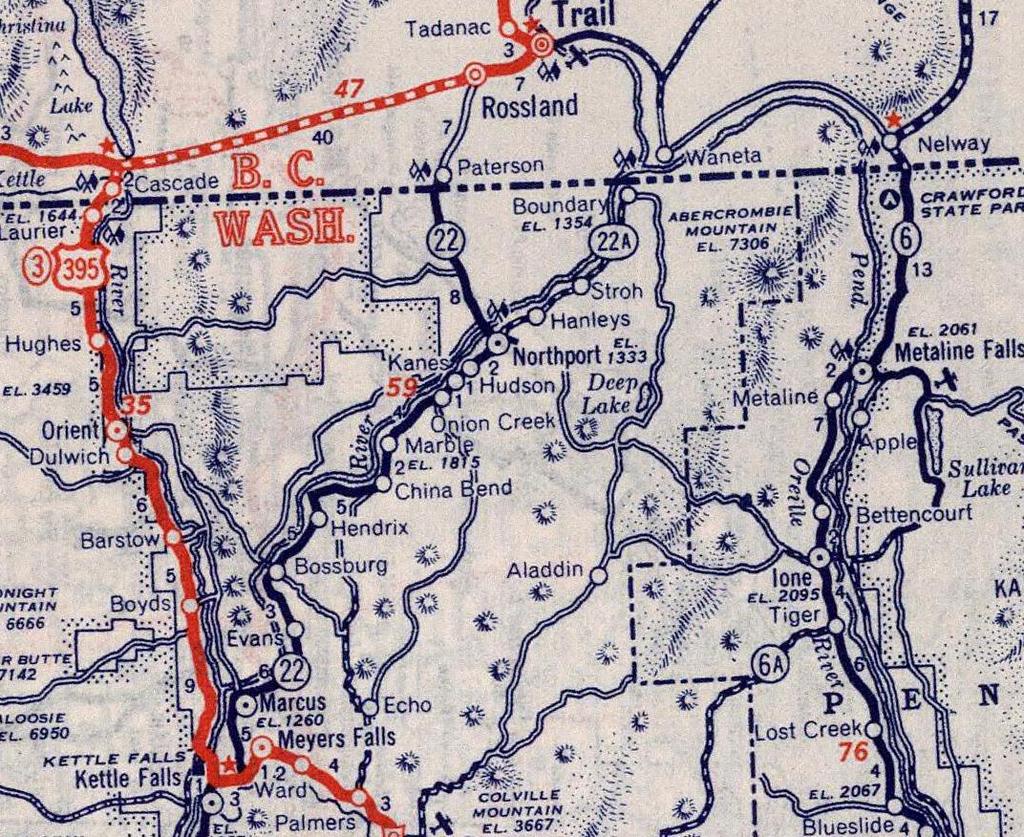
1939 Rand McNally road atlas
showing a number of forgotten towns along the river
showing a number of forgotten towns along the river
[1] Washington State University https://content.libraries.wsu.edu/digital/collection/maps/id/1407/rec/1
[2] [4] [5] [7] [12] David Rumsey Map Collection https://www.davidrumsey.com/
[5] Library of Congress https://www.loc.gov/item/2012593139/
[6] [9] Library of Congress www.loc.gov/collections/sanborn-maps/?q=northport,++washington
[3] [11] U S Bureau of Land Management https://www.blm.gov/or/landrecords/survey/yGrid_ORWA.php?state=WA&ln=10000000
[8] Washington State University https://content.libraries.wsu.edu/digital/collection/maps/id/735/rec/21
[10] U S Geological Survey https://ngmdb.usgs.gov/topoview/viewer/#14/48.5493/-117.8995